Archive for April, 2013
Chilly, Wet End to April
Well, it IS only the middle of spring here so we can’t expect anything better than cool, wet weather. And that’s what we’re getting. It’s been raining pretty much non-stop since Friday afternoon and today we had a mix of rain, sleet, hail and thunder after a two-inch downpour overnight. I was surprised to see a fresh dusting of snow on Mt. Si.

Mt. Si, late afternoon
LBJ Library
We had some free time this afternoon during our brief Texas trip so we visited the LBJ Library on the UTexas campus. I wasn’t a fan of President Johnson at the time but history has shown he had huge accomplishments in combating poverty, promoting civil rights and saving the environment. The Library provided excellent exhibits: countless photos, videos and audio snippets that really capture the tumultuous events of Johnson’s life, especially his years as President.
The current exhibit of dog tags for all the Texans who died in the Vietnam War is sobering. It’s a terrible reminder of the cost of war.

LBJ Library Archives
Related articles
Sunsets/Sunrises Collection
Posted by nbdog in Photo albums, Travel on 7-Apr-2013

Sunset over Colorado River near Moab, UT
Some of my favorite photos are sunrises and sunsets so I’ve put together a collection of some of them.
← Click on the photo to go to the album.
Ogden to North Bend
Our six days in the National Parks flew by. Rather than spend two full days on the return journey we had enough time yesterday to drive all the way to Ogden and make the final 778 mile jaunt home in a single 12-hour push. We’ve done this twice before so it’s getting easier. The weather was perfect and we listened to almost all of a Louise Penny Inspector Gamache mystery, A Trick of the Light. As we got closer to North Bend the weather changed to a light drizzle but we were again impressed with the natural beauty right here where we live. Puffy low clouds hung around the lush green mountainsides and scores of spring-thaw waterfalls cascaded along I-90 through Snoqualmie Pass. We got home in time to have frozen pizza in our own kitchen.
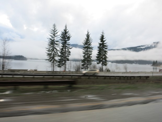
Speeding past Lake Kachess on I-90
Capitol Reef: Cathedral Valley
Posted by nbdog in Photo albums, Travel on 3-Apr-2013
Cathedral Valley is touted as the highlight of Capitol Reef: it’s the sandstone spires from this area that are featured in most of the travel photos of the park. But you are also warned that it is a challenging drive. Both things are true. The scenery is spectacular and the road is horrible. The route begins with a drive across and IN the Fremont River; a very weird experience for non off-roaders like us.
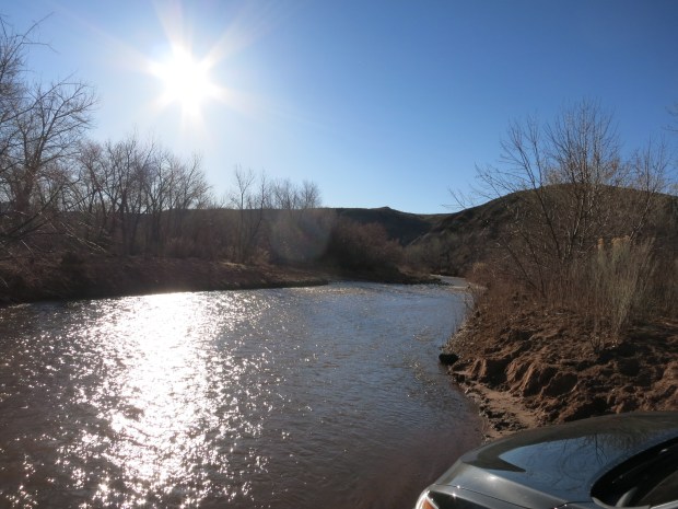
Entering the Fremont River Ford
Once out of the river, we managed a quarter mile or so of deeply rutted, soft sand “road” and drove for a couple of hours on moderately bumpy dirt and gravel. As the route loops over Thousand Lake Mountain the Hartnet Road is very rocky with occasional fallen boulders to avoid and deep washouts to contend with. For almost an hour we barely crept along in the AWD Acura. Back on the Cathedral Valley floor the route becomes Caineville Wash Road which led us past and sometimes right up to several of the Park’s iconic buttes and painted desert landscapes.

Temple of the Sun
The final twenty miles or so traversed magically colored mounds…

… and desolate rocky landscapes …

before we finally exited back onto Highway 24 and signs of civilization. It was an arduous and memorable six-hour tour.
![]() Here are more photos of the Cathedral Valley excursion (37).
Here are more photos of the Cathedral Valley excursion (37).
After lunching at the Fruita picnic area, we rinsed the Acura in a nearby car wash and drove the 200 miles or so to Ogden where we relaxed with room-service burgers while watching a Nova episode on PBS.
Fabulous Day at Capitol Reef Natl Park
Burr Trail Switchbacks into Waterpocket Fold
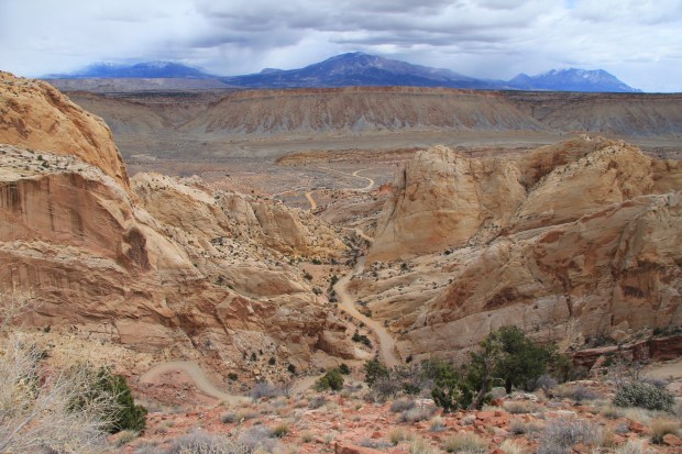
I added Capitol Reef to our Utah itinerary only because it’s so close to Arches and Canyonlands but it has turned out to be the surprise star of our trip. It combines all the colors, shapes and grandeur of Arches, Canyonlands, Bryce and Sedona, AZ to boot. Our day began driving from Torrey to Boulder via scenic byway Route 12 passing over Boulder Mountain at just above 9,600 feet. We passed through a brief snow squall but most of the drive featured wonderful vistas of parts of Capitol Reef and the Grand Staircase Escalante National Monument.
After a brief stop at the Anasazi State Park Museum we descended through the stunning walls of the Grand Staircase via the Burr Trail Road. A brief rain shower only intensified the amazing colors and patterns of the canyon walls. Re-entering Capitol Reef, the paved road ended and we bounced along the next 35 miles on the washboard Notom-Bullfrog Road with its endless vistas of the Waterpocket Fold and Henry Mountains.
![]() Here are some photos of the Burr Trail Road/Waterpocket Fold portion of the trip.
Here are some photos of the Burr Trail Road/Waterpocket Fold portion of the trip.
Returning to the Capitol Reef visitors’ center we spent over two hours doing the ten-mile Scenic Drive taking in still more mind-numbing views of the ever-changing reef colors and textures. Side trips via unpaved roads into Grand Wash and Capitol Gorge offered up perhaps the most grand views of the day. After dinner, as we sped back to our motel room we were treated to still another amazing sunset, as has been the case nearly every day of our trip.
Moab to Capitol Reef National Park
Posted by nbdog in Photo albums, Travel on 1-Apr-2013
Busy day today…. After a yummy breakfast bagel at Sweet Cravings in Moab we stopped at Dead Horse Point State Park. What fabulous views of Canyonlands and the Colorado River.
![]() Additional photos of Dead Horse Point (10).
Additional photos of Dead Horse Point (10).

David and Trisha at Dead Horse Point State Park; Colorado River in the background
From there we toured the bizarre formations at Goblin Valley State Park,
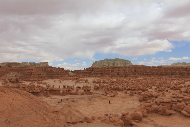
Goblin Valley State Park
a side trip that included a few minutes of black-out conditions in a dust storm.

Dust storm; view through our windshield
![]() Here are some additional photos from Goblin Valley (16).
Here are some additional photos from Goblin Valley (16).
On the way to Capitol Reef we were treated to truly unearthly landscapes along Highway 24 near Hanksville, UT. The day ended with a few miles of preliminary reconnoitering of Capitol Reef in anticipation of tomorrow’s full day tour of the park. Our humble room at the Best Western includes another stunning vista off the back patio:
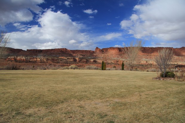
View from patio of our room at the Best Western Motel, six miles of Capitol Reef National
park
